


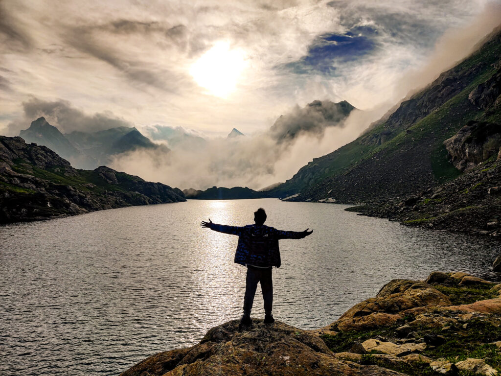
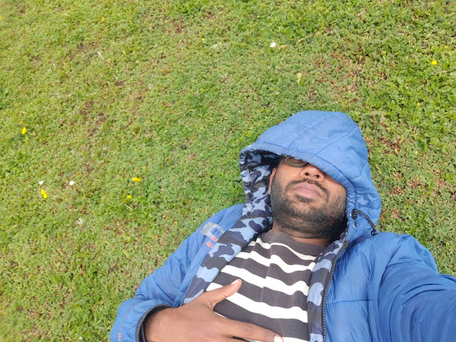
At the end of my 4 months long travel in the Indian Himalayas, I traveled from Ladakh to Kashmir. I was in Kashmir once before 2 years ago. This time It was during the last week of July month in the current year, I decided to do one of the most beautiful treks of India i.e. Kashmir Great Lakes Trek. The trek lasts for 6 days and 5 nights. The trek offers a chance to visit some of the most visually stunning mountain lakes in the world. I really wanted to do this trek but without availing of the services of trekking companies. So I decided to do the trek by myself in DIY mode and It turns out if you are an experienced trekker then you can and you should do this trek by yourself. Not just you will save money but also you will be able to explore a lot more. Read on!


REACHING STARTING POINT OF THE KASHMIR GREAT LAKES TREK
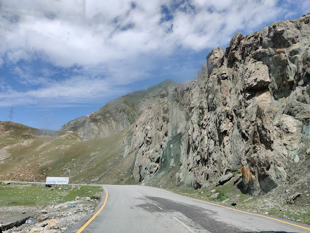
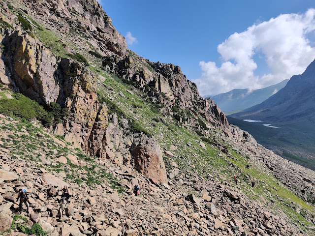
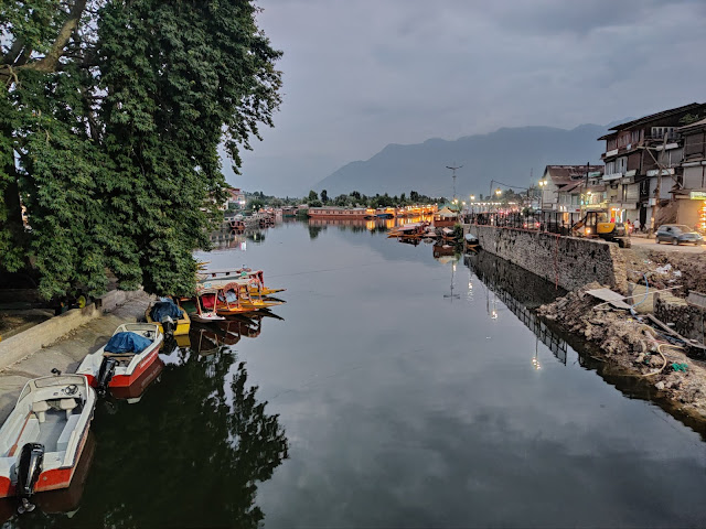
The starting point of the Kashmir Great Lakes trek is Shitkadi Camp which is located around 4 Km before(if you are traveling from Srinagar) the town of Sonmarg. I was coming from Leh. The famous Himalayan circuit ends in Srinagar which is as follows SHIMLA-KINNAUR VALLEY-SPITI VALLEY- MANALI-LEH LADAKH-SRINAGAR. I was staying in the town of DRASS a day before which is considered as the coldest inhabitant place in INDIA. I hitchhiked from DRASS to reach SONMARG. The nearest airport to the starting point of the Kashmir Great Lakes trek is in Srinagar. Government buses ply between Srinagar Airport and Tourist Reception Centre in Srinagar. From Srinagar, you can get a bus or shared taxi to reach Sonmarg. As I said before the starting point is around 4 km before Sonmarg if you are coming from Srinagar. If everything goes well, the Kashmir Great Lakes Trek lasts for 5 Nights and 6 Days. What can be a spoilsport you ask? Well firstly, if a person wishes to spend an extra day in any of the sites in order to rest or explore more. Secondly and more importantly due to rough weather. If it starts to rain heavily and you couldn’t able to proceed further. When I begin my trek, I met many people who were returning back from the second site after spending a couple of days on the site but when the weather didn’t improve they decided to head back. I was lucky when it came to the weather and completed the whole trek smoothly. Well, for the most part 😉


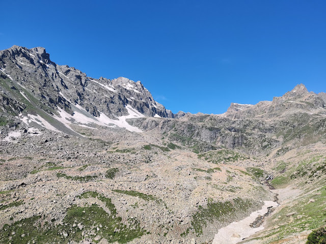
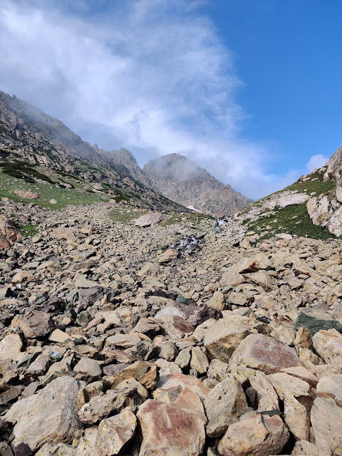
DAY 1: SHITKADI CAMP-TABLETOP MEADOW- NICHNAI
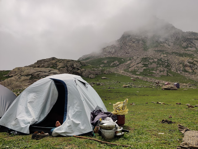
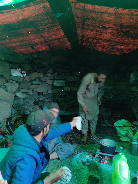
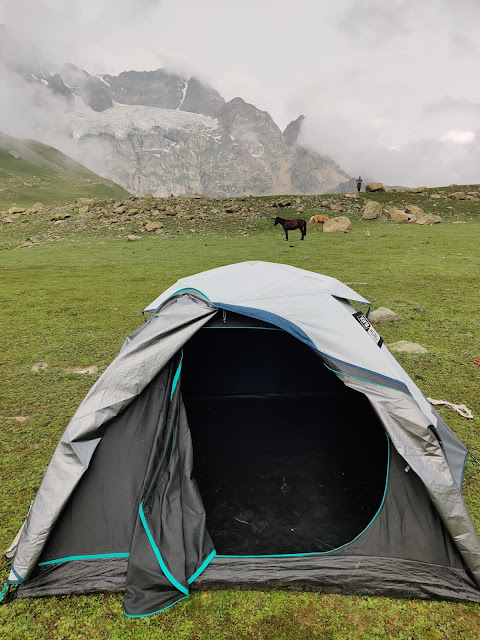
Alright, the day came and I was all excited to do the longest(officially) trek of my life. During my travels, I usually walk anywhere between 10-20 Km in a day regularly. One day 1, I met my trekking companions i.e. Ghulam Bhai (Guide-cum-horseman) and his beautiful horse. The horse carried our luggage which included our tent, blankets, self-inflating mattress, cooking utensils, grocery for a week. I reached the starting point around 9.30 am but we begin our trek at 10.30 am. We reached the first stop of our trek i.e. Tabletop meadow in 90 minutes. Please note that don’t take my time into consideration while planning your trek as the time varies from person to person. For your better understanding, I am going to mention kilometres covered. At Tabletop I met Ghulam Bhai’s family who lives in one of the huts. They offered me a salty tea made from a local plant. It defiantly gave me an energy boost as told by Ghulam Bhai. We reached our next and the final stop of the day in a little more than 2 hours i.e. Nichnai. We reached there by crossing the Nichnai pass with a few snow patches. The way from the starting point to Tabletop is a steep ascend and Tabletop to the camping site of Nichnai is a mix of steep ascend and plain path. After reaching the Nichnai camping site, we set up our tent or more like I set up the tent and teach Ghulam Bhai how to do the same. I took a nap for an hour and then left to meditate near the high-speed river stream. It was such a heartwarming experience which ends in a heart-wrenching experience haha. After I was done meditating, I begin to get up while taking the mobile out of my jacket’s pocket and I lost control of my mobile phone( no, I am not clumsy). It dances down and fell into the river stream. I followed it with a cheetah’s instinct haha and jump into the river. After a few seconds, I grab my mobile phone out of the river but in the process, I lost my awesome hat ??


DAY 2: NICHNAI- VISHNUSAR
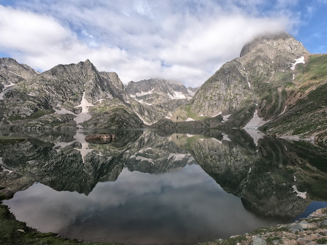
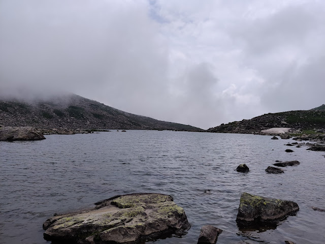
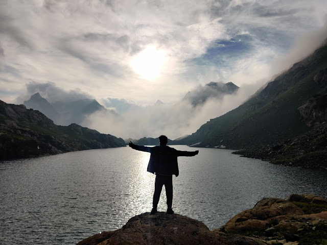
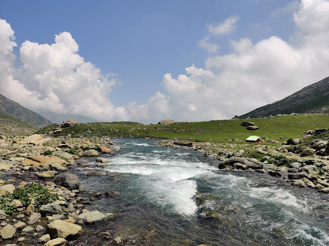
My Guide and Horseman Ghulam Bhai was cautious of the weather on Day 2 suspecting the strong rainfall but he was proved wrong luckily. We begin our trek in the morning around 7.30 AM. On Day 2 we have to reach the first lake of the trek i.e. Vishnusar Lake. The day begins with sunshine and continues for the rest of the day until rain showers at night which lasted briefly. After a couple of hours of mostly steep ascend, I reached a small food shack. You will get Jio mobile network here for calling. Shortly after the food shack, don’t miss trying your hand at sledging without the sledging board ? Afterwards, the rest of the way majorly consists of the plain path with a few snow patches. I had to cross the river stream to reach our camping site near Vishnusar. The water was cold as ice and It was the much-needed adventure before reaching my camping site haha. We camped near the Vishnusar lake. After setting up the camp, I quickly left to see the lake and it was truly “Majestic”. The word became synonyms for lakes in the upcoming days. Do try a fish from the lake if you get a chance. Again, I witnessed the stunning full moon that night. During the night, I met an Israeli couple. They walked all the way from the starting point till Vishnusar. I would also recommend this to hardcore trekkers as the main attractions begin from Vishnusar! The total distance covered on Day 2 was around 13.5 Km. Elevation gain: 11800 ft to 12000 ft


DAY 3: VISHNUSAR- GADSAR
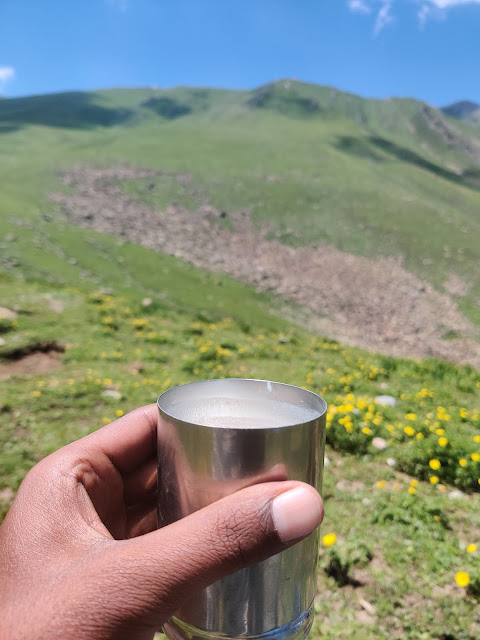
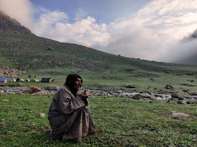
In the morning, my guide announced that Day 3 will be the toughest day of trekking. Well, I beg to differ but I did something off the grid to make it one of the adventurous days of the trek 🙂 As usual, the trek begins with a steep ascend from the neighbouring lake of Krishansar. Krishansar lake is a lake near Vishnusar lake. They are known as twin lakes. You are going to witness it on the way. I would suggest if you have reached early on Day 2 at the Vishnusar camping site. You can also explore the Krishansar lake on Day 2 itself. The view of the twin lakes is truly magnificent after climbing the steep ascend. One can see the Gadsar pass from the top. I begin my descend into Gadsar pass with sledging! Yep, I did another round of sledging copying the method of a young horseman. It was such great fun! Just before the Gadsar lake, I saw the truly “I don’t know how to describe” level beautiful temporary lake. It gives an impression of being tilted. As deceptive as it gets. What a true wonder of mother nature! I decided to cross the river to reach Gadsar lake while my guide shouted behind me. He told me not to cross the river as there’s an easy way to reach Gadsar lake. Well, Give me an adventurous route over an easier route any day ? I neglected his words and threw my pair of shoes with socks in them on the other side of the river. It was a good throw I must say! Maybe I should try my hand at Javelin throw haha. I crossed the river bare feet and it was cold as ice like the day before but most importantly it sufficed my adventurous quench for a while ? After Gadsar lake I continued my journey. A little before the camping site, I saw a group of people near the hut. I approached them for a normal chit chat. They are the family of shepherds who comes to live here during summers for animal grazing. They offered me Chaas (Salty buttermilk) made from Goat’s milk. Less tasty but more healthy! They told me to visit the temporary lake (it dries up in the upcoming months) just behind their home. My instant response was “Yes, please!” haha. It was hidden behind a mountain curve. Therefore, it is not possible to spot it while coming from Vishnusar. This turquoise coloured lake is truly a must-visit. Once I reached the Gadsar camping site, I was sweating. It was really hot with strong sunshine. I decided to take a bath in a river nearby. I would recommend you guys to take bath here if the weather permits(Needless to say, water is really cold). I cooked the usual dal rice for dinner and eat it before sleeping like a baby. The total distance covered on Day 3 was around 17 Km. Elevation gain: Around 12000 ft to 13800 ft to 12200 ft. It does not include my expedition to the temporary turquoise coloured lake.


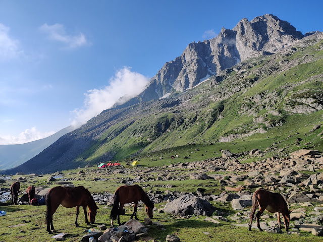
DAY 4: GADSAR-SATSAR
I was really pumped on Day 4 thanks to the previous day adventure. I was already in love with this trek even before I saw the most beautiful lake of the trek:) I begin my trek while climbing a path made completely of snow which acts as a shortcut to reach the mountain pass. It was an easy day for trekking(If you don’t do what I did!) with a few patches of steep ascend. Satsar means Seven lakes. So there are seven lakes (small and big ones) on the way and near to/around our camping site. I met a local Kashmiri guy who came with his friends to do the trek. We decided to explore the 2 mountain lakes on the right side of our camping site. We left for the lakes at around 4 pm. The guy was even faster and crazier than me haha. We reached the first one quite easily and therefore we continued our journey to the second and higher lake. We kept going together and his friends left behind. We made our way where there was no way. To be honest I am a little crazy when it comes to exploring lesser-known places but if I were alone I wouldn’t have taken that path. Now that I think about it, It was crazy as hell what we did. We literally walked on single slippery stones. If we had slipped then there was no chance that we had come out alive. We walked/sledged on a snow-covered mountain pass with no gear and it could lead us into the lake??


DAY 5: SATSAR-NUNDKOL-GANGABAL
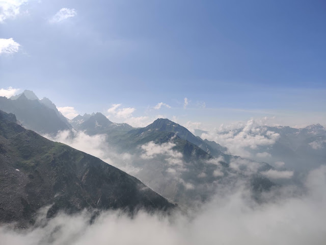
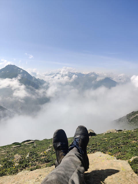
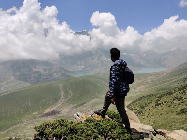
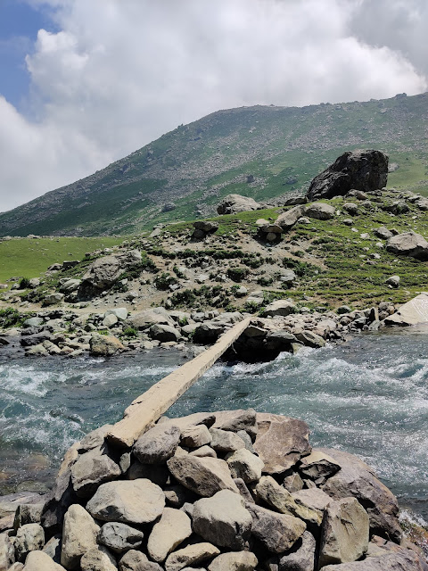
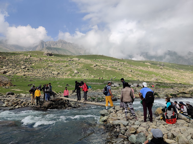
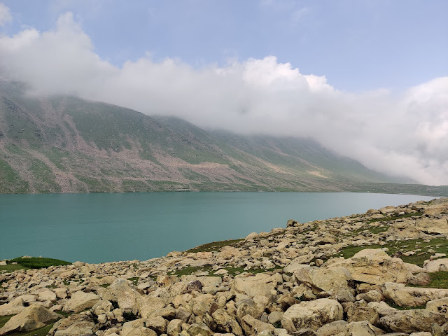
Day 5 trek begins with walking on small and big rocks scattered all the way up to the mountain top. It is a technical trek. You need to be completely focused and confident while walking as one wrong step can hurt your foot. For me, this is another awesome thing about this trek. Apart from the spellbinding lakes, you get through different challenges every day. I loved it! At the mountain top, I saw such a beautiful view of mountains symmetrically covered with clouds. It felt like I was floating on the clouds. After half an hour or so, I reached the Great Wall of snow haha. Seriously though the wall was not that high but it made me wonder about the landscapes here during the winter. Not just at this part of the trek but all of the trek. Well, it must be a sight to behold but needless to say, the trek is closed during winters. From the top, I had a glimpse of two lakes i.e. Gangabal and Nundkol. Due to cloudy weather, the views were not clear but as I begin my descend from the mountain top. Gangabal and Nundkol lakes have become more and more visible. Remember the word “Majestic” haha. Our camping site was near the Nundkol lake. There’s a part where one has to cross a small single wood narrow bridge to reach the campsite. Do not cross it alone by walk. It is not just narrow, It is shaky and uneven. The water current beneath the bridge was too strong and if you fell. You are going to go with the flow literally. I crossed it by sitting and some people crossed it with the help of local people holding their hand. Hopefully, they have revamped the bridge by now. Yesterday’s expedition to two high mountain lakes made me really tired but I pushed myself to go and explore the Gangabal lake. On the way, I saw the mighty Harmukh peak. Mt. Harmukh has a peak elevation of around 17000 ft. Rising above the Nundkol and Gangabal lakes. Gangabal lake is the largest lake on the Kashmir Great Lakes trek. It is well known for fishing too. I reached Gangabal lake after crossing another bridge-like structure made of stones. Remove your shoes and socks before crossing them. I would suggest you explore Gangabal lake before going to the campsite near Nundkol lake if you are not going to spend an extra day here. If you are going to spend an extra day here. Then there are several lakes around Gangabal lake to explore. Check Maps.Me mobile application. The total distance covered on Day 5 was around 9 Km. Elevation loss: Around 12100 ft to 11600 ft. It does not include my expedition to Gangabal lake.


DAY 6: GANGABAL- NARANAG
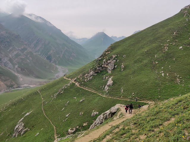
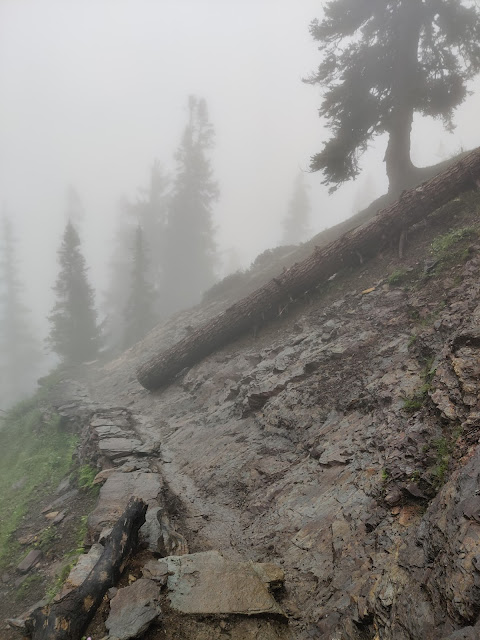
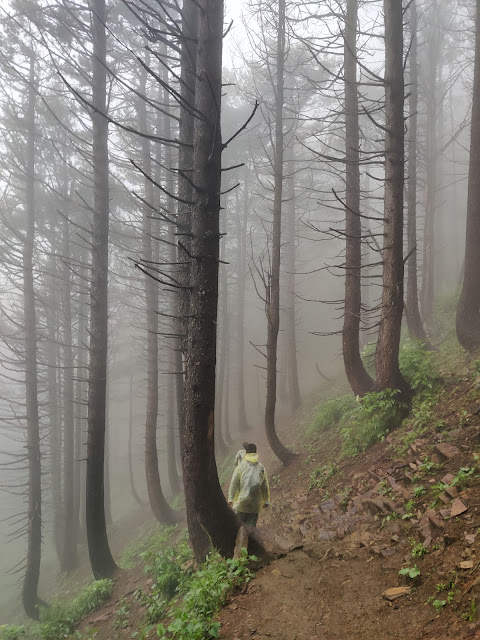
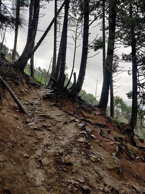
Alright, so Day 6 was the last day of the unforgettable Kashmir Great Lakes trek. Day 6 mostly consists of descending. I with the Delhi guys and the Kashmiri guy decided to cover the distance together. After the 5 days of perfect weather, Day 6 was really cloudy with dense fog. Due to walking in the dense fog, My hair and beard were completely covered with the morning dew. Eskimo, anyone? Thanks to the dense fog we couldn’t able to see the path and lost our way. Luckily, a local shepherd helped us to reach the army post where we met another set of trekkers and horsemen. Here you need to show the trekking permit to the army before going ahead. From the army checkpoint to the town of Naranag, it’s all about descending. It starts to drizzle shortly after which continues mostly for the rest of the way. Do find a wooden stick from the surrounding forest during your descend especially if it’s raining. The path gets muddier and slippier as I approach the Naranag town. Half an hour before the endpoint, there’s a small cafe. Outside the cafe, After 6 days of no internet connectivity, my phone suddenly starts pinging continuously. I didn’t like the sound of that one bit. It was such a beautiful time I spend without the concept of the Internet. Just me and nature. After reaching Naranag town, I couldn’t wait to eat something substantial. I had a local Kashmiri dish called Rista(Mutton meatballs with gravy) and rice. From Naranag town, I hitchhiked in a tempo(the one carrying the luggage of the group of trekkers) back to the main road. From the main road, I board a bus for Srinagar. The total distance covered on Day 6 was around 13 Km. Elevation loss: Around 11600 ft to 7500 ft. It does not include the distance covered when we lost our way. Now, I know you must have a lot of questions regarding the logistics part of the trek. I wrote all the relevant information down below to the best of my ability!

THINGS TO KNOW/CARRY FOR THE KASHMIR GREAT LAKES TREK
- Kashmir Great Lakes trek lasts for 5 nights and 6 days. Do keep buffer days for bad weather or to explore more. July to September are the ideal months to do this trek
- You need a permit to do this trek. You can contact the Tourist Reception Centre in Srinagar for the same.
- Dress in layers for cool mornings, hot afternoons(If you are lucky?) and cold nights. Things to carry are Inner thermal, Full sleeve T-shirts, light full sleeve Sweater, Padded Jacket, Trek pants, Woollen cap and socks, Sunglasses and a Hat with flaps.
- Rain is always around the corner. Therefore, carry a good raincoat. Needless to say, good waterproof trekking shoes are a must. Trekking poles can come in handy. Don’t forget to pack Sunscreen (50+ SPF), Lipguard, Cold cream, Toilet paper, Water bottle and First aid kit.
- Consult your doctor for AMS related medicine. You will be traveling up to 14000 ft elevation.
- You need cooking utensils, a portable gas stove with a pack of gas cans, Sleeping bags, Sleeping mattress, a Sleeping tent, groceries as per your need. Do pack dry fruits!
- You need to hire a guide-cum-horseman to carry your luggage. The charges vary from INR 600 to INR 900 a day per horse depending upon the luggage and your negotiating skills. You need to take care of the horseman’s sleeping and eating arrangements. You will find plenty of horsemen in Sonmarg. Carry a light backpack to make the most out of the trek.
- If you are traveling alone. I suggest you stick with a group. This is for your own safety and well-being. The trek is really famous and populated with many groups. Also, there are some days when horsemen take different routes made for horses.
- If you can, explore the many hidden lakes nestled into the mountains which trekking companies won’t take you due to limited time and fixed itinerary. It is a great pleasure to explore the unexplored. Again, I suggest you go with someone instead of venturing out solo. The best way is to take help from a shepherd and pay them accordingly. They know every nook and corner of the mountains. The best guide one can get!
- There’s no internet connectivity during the trek which for me is the best part except for a place on Day 2 where you will get a signal near the food shack for calling.
- The nearest airport is Srinagar from the starting point of the trek.
- Lastly, I would rate this trek as moderate in terms of difficulty. Please note that this is my opinion according to my stamina and resistance power. I saw kids(12 years olds) and old people(60+ years old) doing the trek.